About Us
Automated Waterlevel and Rain Monitoring using near-Realtime Observation (ALeRTO)
The Automated Water-Level and Rain Monitoring Using Near-Real Time Observation (ALeRTO) is an early warning system developed by the Ateneo de Zamboanga University-GeoSAFER Mindanao ZAMBASULTA Program. The system makes use of the Automated Rain Gauges (ARGs) and Automated Water-Level Sensors (AWLS) which were installed in the different river systems in the Region. The device is programmed to monitor the DOST-Advanced Science and Technology Institute (DOST-ASTI) for the critical water level and rain data; and the Philippine Atmospheric, Geophysical and Astronomical Services Administration (PAGASA) for the status of the hydro-meteorological data in the region. The device determines the threshold category in each river, which is represented by the different color warnings. Once the device determines that a particular river has reached a certain threshold, it will automatically send out alert messages via SMS to registered users, specifically to Local Government Units. The SMS will contain the threshold interpretation, along with the rain and water level values. The said data could also be viewed through the ALeRTO Website. Through this system, the office aims for the local authorities and communities to be more prepared for possible effects brought by continuous rain event. As the system will send the water level and rain level updates, the local authorities will have enough time for decision making to prevent the adverse effects brought by flooding.

10 Pilot Areas
- Siocon River - Municipality of Siocon
- Kipit River - Municipality of Labason
- Salug River - Municipality of Salug
- Sindangan River - Municipality of Sindangan
- Tangian River - Municipality of Pres. Manuel A. Roxas
- Manicahan River
- Tumaga River
- Municipality of Bayog
- Municipality of Diplahan
- Municipality of Imelda
- Municipality of Siay
- Municipality of Payao
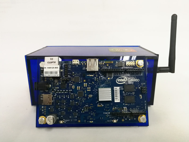
Image of ALeRTO v1 Device
Partners


OCD 9

DOST 9

DILG 9